


Map Index
Summit County began to emerge in 1788 from half Indian Territory and half of Washington County. In 1797 Summit was half in Wayne and half in Jefferson Counties. By 1803 all of Summit County was located in the new Trumbull County except Franklin & Green Townships. By 1807 Summit was located in Portage County. By 1818 Summit was half in Medina County and half in Portage County. Created in legislature on February 28, 1840 and celebrated publicly on March 4, 1840, Summit was finally formed from Medina & Portage Counties and two townships from Stark County.
In 1825 Summit consisted of 209 households, 1,517 horses, 8,767 cattle, 1 carriage and 460,008 acres. Today Summit County has approximately 514,000 people, 260,195 miles of roads and 419.38 square miles of property.
The first white persons to live in this county were believed to be Mary Campbell and Mrs. Stuart. They had been captured by Indians during a raid in Pennsylvania. They were held captive by the Delawares (1789) at their village in Big Falls of the Cuyahoga.
- Townships and Ranges
- Fire Lands Map
Published by: Creator Pitt, Savery and Sumner, William 1826 - Surrounding Counties
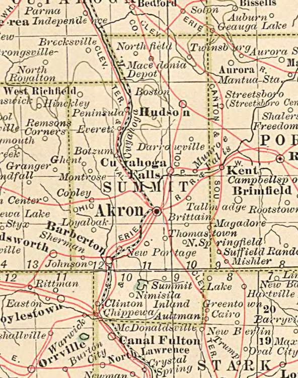
- Map of Akron and surrounding towns
- Century Atlas 1897
Published by: Matthews-Northrup Co., Buffalo, N. Y. - Census Map
Page last updated October 2025
Summit County OHGenWeb Page
Established November 20, 1996